AirNav Radar – Flight Tracker
- 4.4
- Rating
- 1.00M
- Installs
- Free
- Price

 Analysis by App-foxy
I installed AirNav Radar – Flight Tracker expecting a quick way to identify aircraft overhead, but I ended up using it in two very different ways. At first, it is an entertaining window into the sky: open the map, notice a plane passing above, and follow its route in real time. After that novelty settles, its value depends on whether you regularly travel, meet arriving passengers, follow aviation, or simply enjoy understanding what is moving through the air around you.
Developed by AirNav Systems, this free Travel & Local app combines a live aircraft map with flight-finding and navigation tools. It is available to Everyone, runs on Android 7.0 and newer, and the current version is 3.2.5. The app has reached over one million installs and holds a 4.4 average from around 6,200 ratings, which matches my impression that it is more than a novelty toy but still serves a fairly specific audience.
What AirNav Radar feels like during the first week
The first session is easy to understand. I opened the map, looked for nearby aircraft, and tapped around to see what was currently overhead. That immediate connection between the moving dots and the real sky is the strongest part of the experience. You can stand outside, hear an engine, and use the app to turn a vague guess into a more informed look at the aircraft’s position and route.
You May Also Like

 Blood Strike: 2.5 Anniversary
Blood Strike’s Loadouts Turn Every Drop Into a Tactical Gamble
A close look at Blood Strike’s custom loadouts: how fast access to signature weapons reshapes its battle royale rhythm, rewards preparation, and narrows the gap between fights.

 Pandora - Music & Podcasts
Pandora’s Music Is Easy to Start, but Harder to Recover
Pandora’s strength is its low-effort path from a seed to a station. Its weak spot is how much confidence it asks you to place in connection, setup, and quiet recovery.

 8 Ball Pool
 Is Built on Rivalries, Rematches, and Routine
A close look at the rivalries, rematches, shared routines, and unanswered safety questions that turn a quick pool match into a persistent mobile community.

 Samsung Music
’s Quiet Strength Is Playing What You Already Own
Its reach comes less from spectacle than from dependable access to a personal library. That simplicity is both the app’s strongest retention engine and its ceiling.

 AccuWeather: Weather Radar
AccuWeather Review: A Quick, Clear Forecast for Everyday Decisions
For everyday plans, the best forecast is the one you can understand quickly. AccuWeather makes rain timing, radar, and local conditions easy to act on, with a few trade-offs.

 Hill Climb Racing
Why Hill Climb Racing Still Turns Crashes Into One More Run
A tiny car, a bumpy hill and one more upgrade: Hill Climb Racing keeps resurfacing because its simple chaos makes every near-miss feel personal.
More From Our News Desk



That makes the app especially appealing in the first week. It gives ordinary moments a small sense of discovery without requiring aviation knowledge. A flight passing over a neighborhood becomes something you can investigate, and an airport trip becomes more interesting because the map gives context to the traffic around it. I found myself checking it while walking, near a window, and before leaving for an airport—not because every session was essential, but because the information was available at exactly the right moment.
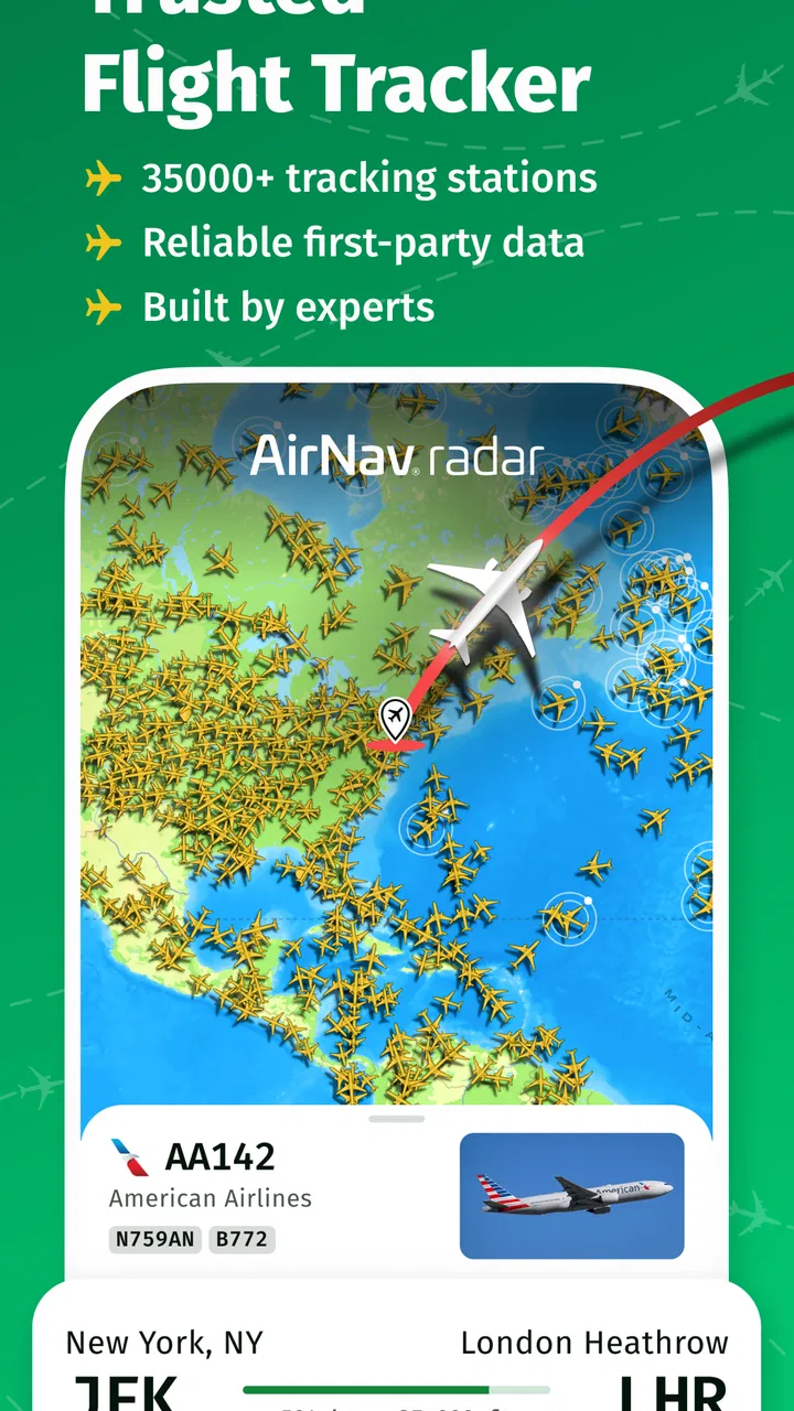
The interface is best understood as a visual tool rather than a traditional travel planner. The map does the talking. Instead of beginning with a long search form, I could start from what was happening around me and then move toward a particular aircraft or flight. That direction feels natural when I am curious about a plane overhead, while a conventional airline or airport app is usually better when I already know the booking or departure I need.
For travelers, the early appeal is practical. If someone is collecting a passenger, watching nearby traffic can help build a sense of whether the airspace is active and where an aircraft is moving. I would not treat the app as a replacement for official airport instructions, airline messages, or a confirmed itinerary, but it is useful as an extra layer of awareness. The difference matters: a live tracker can help me understand a situation, while the airline remains the authority for check-in, gate changes, baggage, and disruption notices.
Another enjoyable use is sharing the moment with someone who is not familiar with aviation. Rather than saying “there is a plane up there,” I can show the map and explain what I am looking at. That turns the app into a conversation starter. It also works well for families, curious children, and anyone who likes maps but does not want a complicated technical dashboard.
My first-week caution is that the excitement can be stronger than the lasting usefulness. The map invites repeated checking because aircraft are always moving, but not every movement deserves attention. If your surroundings have little air traffic, or if you are not interested in routes and aircraft, the experience may become repetitive quickly. The app earns its place initially through immediacy; keeping it installed requires a reason to return.
Useful habits that make the map more valuable
I got more from it when I opened the app with a question instead of simply staring at the screen. For example, I might check which aircraft are approaching an airport, identify a plane heard above my home, or look at the route of a flight connected to a trip. That small change prevents aimless browsing and makes the live map feel like a tool rather than a constantly moving wallpaper.
A second useful habit is to check the app before interpreting what I see outside. Sound can travel in ways that make an aircraft seem closer or farther away, and a plane may not be where I expect it to be when I look up. Using the map first gives me a reference point, then looking at the sky becomes more rewarding. This is a simple workflow, but it is more satisfying than opening the app after I have already lost sight of the aircraft.
I also found that the app works better as a companion to a journey than as the journey’s main organizer. Before heading to an airport, I can use it to understand the surrounding activity and satisfy my curiosity. During the actual trip, I would switch back to the airline’s app, airport signage, and official announcements. Keeping those roles separate avoids one of the most common mistakes with live tracking tools: expecting them to answer operational questions they were not designed to own.
Why month-to-month value depends on your routine
After the first month, the question changes from “Is this interesting?” to “When will I actually open it?” For me, the answer came down to recurring situations. The app has lasting value for people who fly often, live near an airport, follow particular routes, meet travelers, or enjoy aviation as a hobby. For everyone else, it may remain installed but unused after the initial curiosity fades.
Frequent travelers can use the tracker as a visual companion before and after a trip. It helps connect a flight number or route with the wider movement around an airport. That context is not the same as a booking record, but it can make travel feel less abstract. If I am waiting for someone, the map may give me an additional way to understand where a flight is in relation to the airport. I still want the traveler’s confirmed arrival information for decisions, yet the tracker can make waiting less blind.
People who live beneath busy flight paths have another reason to return. The app can help separate occasional traffic from a familiar pattern. Over time, I can use it to notice when the sky is unusually active or when a plane I hear is moving in a direction I did not expect. This is not a scientific monitoring system in my hands; it is a practical way to connect everyday sounds with visible information.
Aviation enthusiasts will probably get the most repeat value. The pleasure is not only finding one aircraft but returning to compare situations: a quiet afternoon, a busy arrival period, or a route that catches my attention. The map becomes a regular observation point. That said, a dedicated enthusiast may eventually want deeper aircraft records, historical tools, alerts, or specialized analysis. AirNav Radar is more approachable than a highly technical platform, but that accessibility may also feel limiting to someone who wants exhaustive detail.
The app is less compelling for a person who only wants to check one scheduled trip. In that case, the airline’s own application or an airport’s official information is usually more direct. Those alternatives are built around reservations, boarding details, terminal information, and changes affecting a specific passenger. AirNav Radar is better when the question is “What is happening in the air?” rather than “What do I need to do for my booking?”
It is also not the right choice if you need guaranteed operational certainty. A tracker should not replace a confirmed airline update when deciding whether to leave home, pick someone up, or make a connection. I treat it as an independent view that adds context, not as the final word. That distinction is one of the most important long-term lessons because live information can feel authoritative even when my practical decision requires an official source.
Three recurring use cases that are easy to overlook
The first is using the app as a meeting aid without relying on it alone. If I am collecting someone, I can follow the aircraft’s progress to understand the broad stage of the journey, then confirm the actual arrival through official channels. This can reduce pointless waiting, especially when the airport is busy, but it does not justify changing plans based solely on the map.
The second is building a personal aviation routine. I can check the map at a consistent time, notice which routes appear around me, and gradually become familiar with local traffic. The benefit is not a single piece of information; it is the habit of giving names and direction to aircraft that would otherwise pass unnoticed. That makes the app more durable for curious users than for people who only want a one-time answer.
The third is using it to investigate sound rather than sight. When I hear an engine but cannot see the aircraft, opening the map can provide a starting point for identification. This is particularly useful in urban areas where buildings, weather, or darkness make visual spotting difficult. It is a small feature of the overall experience, but it is one of the reasons I can imagine returning even when I am not traveling.
Maintenance, payments, and the effort of keeping it useful
AirNav Radar is free to download, which makes trying it low-risk. The app also includes optional in-app purchases ranging from $2.99 to $599.99 per item. That wide range deserves attention before anyone taps through a purchase screen. I would begin with the free experience and decide whether the app has become part of my routine before considering any paid option. A tracker should earn repeated use first; curiosity alone is not a good reason to spend.
I also recommend checking what a paid item changes before confirming it. The existence of in-app purchases does not automatically mean the free version is inadequate, but it does mean the app should be evaluated as a free starting point rather than assumed to be completely feature-unlimited. For an occasional user, the free access may be enough. A committed aviation follower may judge optional tools differently, depending on how often they use the map and what level of detail they want.
The maintenance burden is fairly light in the everyday sense. I do not need to build a profile of every flight or prepare a complicated database before using the map. The main work is mental: remembering that live tracking is most useful when connected to a specific question. If I open it without a purpose every day, the novelty wears down. If I use it around travel, local aircraft activity, or a genuine observation habit, it remains easier to justify.
Version 3.2.5 suggests that the app is being maintained as a continuing product rather than left as a one-off experiment. Still, maintenance for a live-data app is not only about installing updates. My own routine matters more. I need to keep the app in the role it handles well, avoid treating it as an official travel authority, and resist paying for extras simply because they are visible.
Device compatibility is another practical point. Because it supports Android 7.0 and newer, it can serve people with older Android phones that are not limited to the latest operating system. That broad compatibility is helpful if I want to keep a secondary phone near a window or use an older device during travel. I would still judge the experience by how comfortably the map runs on the specific phone, especially if the device is aging, but the minimum system requirement is not unusually restrictive.
The Everyone age rating also makes it suitable for shared use at home. I can hand it to a child who is curious about planes without the app presenting itself as an adults-only product. Supervision is still sensible for any device use, particularly around purchases, but the rating fits the app’s educational and observational character.
Where repeated use can become tiring
The biggest source of fatigue is repetition. Aircraft move constantly, but the basic action remains similar: open the map, inspect traffic, and follow something interesting. That loop is satisfying when I have a reason to look, yet thin when I am checking simply because the app is available. The more often I open it without a question, the faster the sense of discovery disappears.
Another possible frustration is the gap between visual confidence and practical certainty. A moving marker feels precise, and that can encourage me to make assumptions about arrival timing or what I should do next. I have to remind myself that a live map is an aid to understanding, not a promise. For travel decisions, the airline and airport remain more relevant. This is not a flaw unique to one screen; it is a trade-off built into the whole category.
Map-based apps can also demand more attention than I expect. When I am traveling, I may want a quick answer while carrying luggage, watching signs, or moving through a crowded terminal. A dedicated airline app can be more efficient for that moment because it puts my booking and immediate instructions first. AirNav Radar rewards exploration, while travel logistics reward brevity. Choosing the wrong tool creates friction even when the tracker itself is working properly.
There is also a difference between being interested in flights and being interested in aviation detail. A newcomer may appreciate the approachable map, while an experienced enthusiast may want more depth than a general-purpose tracker provides. I would not call that a weakness for everyone. It is simply a sign that the app sits between a casual visual companion and a specialist instrument. Its broad appeal comes from being easy to enter, but its ceiling may feel lower for advanced users.
Finally, the purchase range means I would avoid browsing optional upgrades casually. A free app can encourage relaxed experimentation, but a purchase screen changes the decision. I would read each option carefully, consider how often I really use the app, and compare the benefit with the simpler alternatives already on my phone. The right question is not whether an extra looks interesting; it is whether it solves a recurring problem that the free experience leaves unresolved.
My long-term verdict on keeping it installed
I think AirNav Radar – Flight Tracker earns lasting space on my phone when it connects to a real habit. If I fly regularly, live under a busy route, meet passengers, or enjoy tracking aircraft for its own sake, the app offers a pleasant and useful way to make the sky more understandable. Its free entry point, approachable map, and broad compatibility make it easy to test without committing to a specialist setup.
I would recommend it to a friend who says, “I keep wondering what that plane overhead is,” or to someone who wants extra context around airport activity. I would also suggest it for families and casual aviation fans who prefer discovering information visually. The strongest long-term use is not constant monitoring. It is opening the app at the right moments and using it to answer a question, support a travel routine, or deepen an existing interest.
I would not recommend making it the main travel app. If your priority is boarding passes, gate changes, baggage instructions, or reservation management, use the airline and airport tools first. If you only need a single confirmed arrival time, a focused travel service may be quicker. And if you want highly specialized aviation analysis, you may eventually outgrow a broadly accessible tracker.
My final judgment is positive but selective. The first-week appeal is immediate, while the month-to-month value comes from repetition with purpose. The maintenance burden is manageable, but the user has to control the habit rather than let the moving map become background noise. The app is worth keeping when the sky is part of your routine, not merely when the novelty is still fresh.
FAQs for AirNav Radar – Flight Tracker
01What features does AirNav Radar – Flight Tracker offer?
AirNav Radar provides real-time flight tracking, allowing users to view live aircraft positions on a detailed map. The app also includes comprehensive flight details such as altitude, speed, and flight path. Users can access historical data and set alerts for specific flights, making it a robust tool for aviation enthusiasts and professionals.
02Is AirNav Radar – Flight Tracker available for both Android and iOS?
Yes, AirNav Radar – Flight Tracker is available for download on both Android and iOS platforms. Users can easily find the app in the Google Play Store and Apple App Store, ensuring compatibility with a wide range of devices. Make sure your device meets the app's system requirements for optimal performance.
03Does AirNav Radar – Flight Tracker require a subscription or is it free to use?
AirNav Radar offers a basic version that is free to use, providing essential flight tracking features. However, for advanced functionalities such as accessing historical data, setting alerts, and removing ads, users may need to subscribe to a premium plan. Pricing details are available within the app's settings menu.
04How accurate is the flight data on AirNav Radar – Flight Tracker?
The app utilizes data from various reliable sources, including ADS-B, MLAT, and radar, to ensure accurate and up-to-date flight information. While the app strives for precision, occasional discrepancies can occur due to factors like data transmission delays. Users are advised to cross-check critical information when necessary.
05Can I track international flights using AirNav Radar – Flight Tracker?
Yes, AirNav Radar allows users to track flights globally, covering a vast network of international air traffic. The app provides real-time updates on flights from major airlines worldwide, making it an excellent choice for users interested in tracking both domestic and international flights.
Pros
- Comprehensive real-time flight data
- User-friendly interface design
- Customizable notifications
- Global coverage for flight tracking
- Detailed aircraft information
Cons
- Requires constant internet connection
- Can be overwhelming for beginners
- Some features locked behind paywall
- Occasional data refresh delays
- Battery consumption can be high

AirNav Radar – Flight Tracker
Gallery